Florida
Coffee News® in Florida
Affordable advertising in Florida.
Discover affordable advertising in Florida. Advertise in your local community.
Advertising Rates, Readers’ Contests, and What’s Happening events are all managed by your local publishers/owners. To contact your local Coffee News publisher, use our listing below.
Tyeshia Pegram and Carmen Shelly
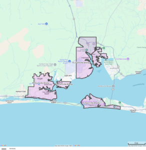
Coverage Area
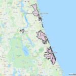
- Fort Walton Beach
- Mary Esther
- Cinco Bayou
- Ocean City
- Wright
- Shalimar
- Lake Lorraine
- Valparaiso
- Niceville
- Destin
Boundary Map – Click to view full size map.
- Click here to email Tyeshia.
- Click here to email Carmen.
- 475-202-9593 (Tyeshia).
- 469-964-1896 (Carmen).
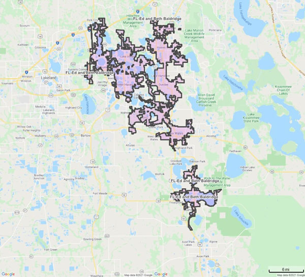
Ed and Beth Baldridge
Click here to email
www.ridgecoffeenews.com
Coverage Area
- Lake Wales
- Frostproof
- Dundee
- Lake Hamilton
- Haines City
- Lake Alfred
- Auburndale
- Winter Haven
- Davenport
Boundary Map – Click to view full size map.
Lisa Marie Blackburn
Click here to email
352-598-6117
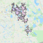
Coverage Area
- Ocala
- Belleview
- Silver Springs
- Dunnellon
- Summerfield
- Ft. McCoy
- Citra
- Salt Springs
- Orange Springs
- Inverness
- Hernando
- Crystal River
- Beverly Hills
- Homosassa
- Leesburg
- Tavares
- Mt. Dora
- Eustis
- The Villages
- Lady Lake
- Wildwood
- Interlachen
- Melrose
- Hawthorne
Boundary Map – Click to view full size map.

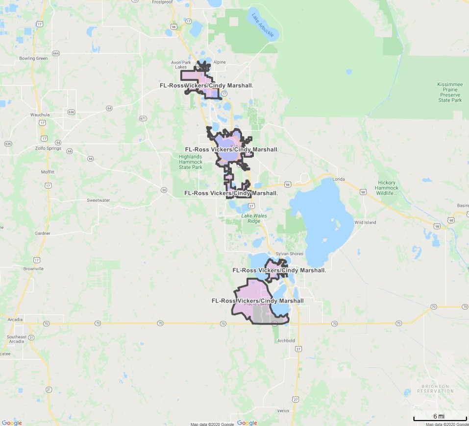
Cindy Marshall / Ross Vickers
Click here to email
www.coffeenewsfla.com
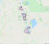
Coverage Area
- Lake Placid
- Placid Lakes
- Sebring
- Avon Park
Boundary Map – Click to view full size map.
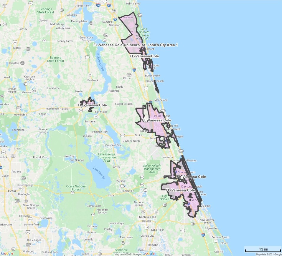
RANDY & VANESSA COLE
Click here to email
www.coffeenewsneflorida.com
Coverage Area
- St. Augustine
- St. Augustine Beach
- St. Augustine South
- Palm Coast
- Palatka
- Crescent Beach
- Flagler Beach
- Ormond Beach
- Ormond By the Sea
- Holly Hill
- Daytona Beach
- Daytona Beach Shores
- South Daytona
- Port Orange
Boundary Map – Click to view full size map.
Unincorporated St. John’s County Area 1
North: International Golf Parkway at I-95 on the west. Headed east along the International Golf Parkway to US-1. North along US-1 to CR-210 (Palm Valley Road). East along CR-210 (Palm Valley Road). To the Intercoastal Waterway on the east.
South: SR-206 at I-95 on the west. Headed east along SR-206 to US-1 on the east.
East: The Intercoastal Waterway at CR-210(Palm Valley Road) on the north. Headed south along the Intercoastal Waterway to the St. Augustine city line. South from the St. Augustine City line at the intersection of SR-207 and US-1. South along US-1 to SR-206 on the south.
West: I-95 at the International Golf Parkway on the north. Headed south along I-95 to SR-16. East along SR-16 to the St. Augustine city line. Headed south along the St. Augustine city line to SR-207. West along SR-207 to I-95. South along I-95 to SR-206 on the south.
*includes distribution locations along both sides of the outer boundary streets.
*includes distribution at World Golf Village.
Other USA Locations
- Alabama
- Alaska
- Arizona
- Arkansas
- California
- Colorado
- Connecticut
- Delaware
- Florida
- Georgia
- Hawaii
- Idaho
- Illinois
- Indiana
- Iowa
- Kansas
- Kentucky
- Louisiana
- Maine
- Maryland
- Massachusetts
- Michigan
- Minnesota
- Mississippi
- Missouri
- Montana
- Nebraska
- Nevada
- New Hampshire
- New Jersey
- New Mexico
- New York
- North Carolina
- North Dakota
- Ohio
- Oklahoma
- Oregon
- Pennsylvania
- Rhode Island
- South Carolina
- South Dakota
- Tennessee
- Texas
- Utah
- Vermont
- Virginia
- Washington
- West Virginia
- Wisconsin
- Wyoming
Interested in more than a single location? For inquiries on statewide or nationwide advertising information, please contact us by phone or using our Inquiry Form. Click here to go to our contact page.


Population and number of restaurants will vary from market to market, but typically areas of under 50,000 population provide ideal conditions single edition territories.